
"The reader may think that I am dwelling unduly on the subject of roads, but I do so at this juncture because it was a subject which now became of increasing magnitude. Practically the last sign of paved road of any kind between this point and the Pacific Coast (some 2,500 miles away) would be encountered at Indianapolis, and from there onwards were universally the execrable "dirt" roads that so seriously threaten not only the comfort but the safety of motor-cycling. I was not even disappointed at the outlook, because I came to America without even expecting any form of trail or route across its entirety to be at my disposal. But I feel the natural resentment of the Englishman when I am led to believe that there is a luxurious "highway" ahead, only to find an aggravated series of dust-heaps, mud-pools, and cow-paths!"-C.K. Shepherd
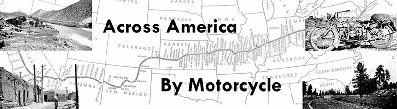
Shepherd traveled over roads that had names-- the Pike's Peak Ocean to Ocean Highway, the National Old Trails Road (pictured in the map at the top of the page), the Santa Fe Trail-- all before the route numbering system began.
In some cases he mentions specific roads, but more useful is his habit of listing just about every city, town and burg he passes through, even if only to wonder that so small a place shows up on his map at all.
The cities are more useful in figuring out where he went because the roads themselves were moved, in some cases several times over the years before disappearing almost entirely under newly constructed roads. Many of Shepherd's "highways" were the trails used by settlers during the westward expansion, and had seemingly not been much improved as he struggled to find his way between ruts in the mud left by cars and wagons. Some followed next to the railways, to be near a source of supplies. In some cases, he couldn't figure out where the road was even supposed to be.
The map above this post, (click here for a larger image) from the excellent American Roads site, of the National Old Trails Highway follows Shepherd's path pretty closely, and illustrates the difficulty of figuring out where it was-- maps of the US from the teens and twenties just don't seem to have a lot of detail. A lot of them are more like the old AAA triptiks than actual maps.
I'm still researching the roads, and wishing I had started this a few months ago, but it looks like Route 40 follows pretty much the same path as the National Old Trails Road (with a few detours), more or less through Kansas and just into Colorado, where Shepherd hangs a left to head down the Santa Fe Trail. I should say right up front that I'm not planning on visiting New York or Washington, DC on this trip, partly because I go to both of them fairly often, and partly because, let's face it, I've got a long trip ahead of me, I don't need to be adding anything for historical accuracy. I'll probably give Cincinnati (where Shepherd detours to pick up money from the post office) a miss as well.
So anyway, looks like I'll pick up his trail in Hagerstown, head west to La Junta, CO; then South to Albuquerque, NM; west again to Los Angeles, and up the California coast to San Franscisco.
When you put it that way, it sounds pretty straightforward.
Edit: Something like this, as far as I can tell.

No comments:
Post a Comment